• Recent
  • Towns
  • Topics
    • Arts
      • Language
      • Museums & Galleries
      • Public Art
    • Civic Life
      • Citizen Engagement
      • Governance
      • Health & Well-Being
      • Refugees
    • Community Heart & Soul
    • Economic Development
      • Breweries & Distilleries
      • Entrepreneurs
      • Transportation
    • Education
      • K-12
      • Community Colleges & Technical Training
      • Colleges & Universities
    • Environment & Sustainability
      • Parks & Recreation
      • Trees
    • Local Institutions
      • Libraries
    • Local Journalism
    • Travel
      • Aviation
  • Homepage
  • About
  • Donate
  • Newsletter
  • Recent
  • Towns
  • Topics
    • Arts
      • Language
      • Museums & Galleries
      • Public Art
    • Civic Life
      • Citizen Engagement
      • Governance
      • Health & Well-Being
      • Refugees
    • Community Heart & Soul
    • Economic Development
      • Breweries & Distilleries
      • Entrepreneurs
      • Transportation
    • Education
      • K-12
      • Community Colleges & Technical Training
      • Colleges & Universities
    • Environment & Sustainability
      • Parks & Recreation
      • Trees
    • Local Institutions
      • Libraries
    • Local Journalism
    • Travel
      • Aviation
  • Homepage
  • About
  • Donate
  • Newsletter
  • Aviation

‘Baltimore Altimeter, 30.46’

Snapshots From a Clear Day in the Northeast

  • James Fallows
  • September 17, 2013

Share

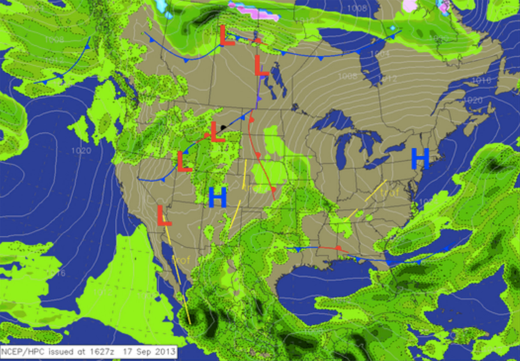
Yesterday my wife mentioned that part of the inflight ritual, when you are traveling on an instrument flight plan or getting “flight following” from controllers, is hearing and acknowledging the right altimeter setting as you move from one airspace sector to the next. “Standard” pressure is defined as a reading of 29.92 — or “two niner niner two,” as you would hear it on the radio. Let’s skip the details of what that refers to. In the simplest practical terms, the lower the number, the cloudier and wetter the weather is likely to be around you. The higher the number, the clearer and drier — because you are in a high-pressure system, in which colder, drier, clearer air is pushing down from the upper altitudes, increasing the atmospheric pressure beneath it and moving clouds and everything else out of its way.

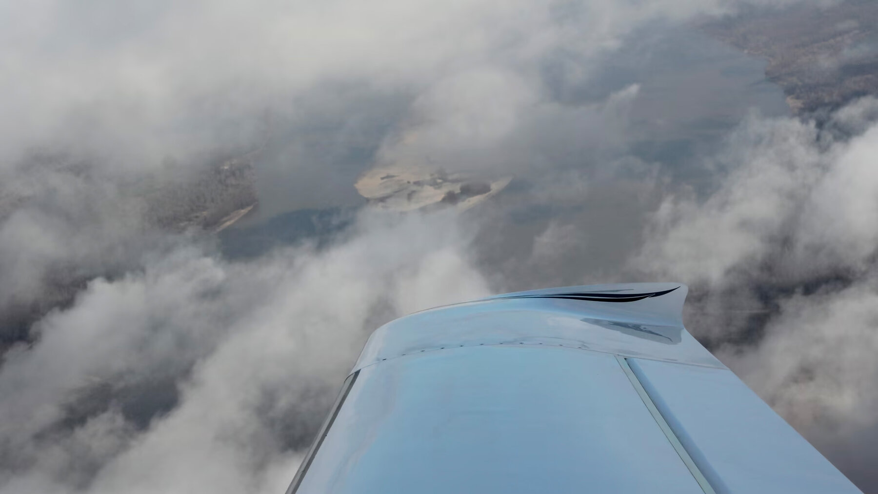
That’s why when you see a giant H (for high-pressure) on a weather map, like the one above, you expect clear skies, and winds that follow a clockwise rotation around its periphery. Obviously there’s much more to say on these themes, but for now the point is that there was a great big H in the northeast today; it led to an altimeter setting of 30.46 on our takeoff and at most points along the route, which is far from a record but is higher than I usually see; and it created vista-to-the-horizon conditions as we were traveling from the DC area back to northern Vermont. A few samples — which are snapshottish because they were taken through the glare-prone plastic windows of the plane but which give you an idea of what it looks like as you swim through the air on this kind of trip.

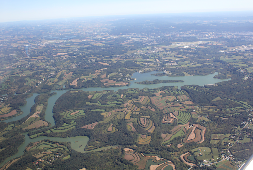
How Maryland farmland looks, just two minutes after take-off not far north of DC. The blue line in the distance is the Chesapeake.

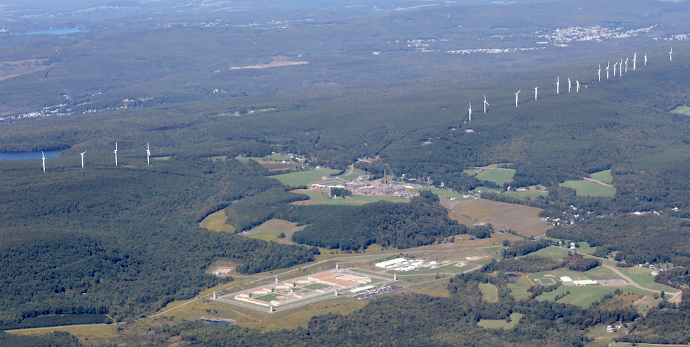
I’ve mentioned before that three parts of the American landscape are way more evident on small plane flights than from ground-level: quarries, prisons, and (through the past decade) windmills and wind turbines. Two out of three isn’t bad for a single picture, from northeastern Pennsylvania this afternoon. In the foreground, a maximum-security men’s prison. On the ridge line behind it,  wind turbines. We had passed a couple of quarries a minute earlier.

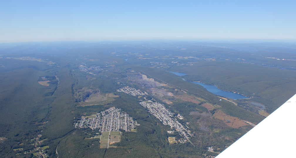
American industrial/design history on display: looking along a ridge in the coal country outside Scranton and Wilkes-Barre, with the coal face on the right and the town built along on the ridge top.

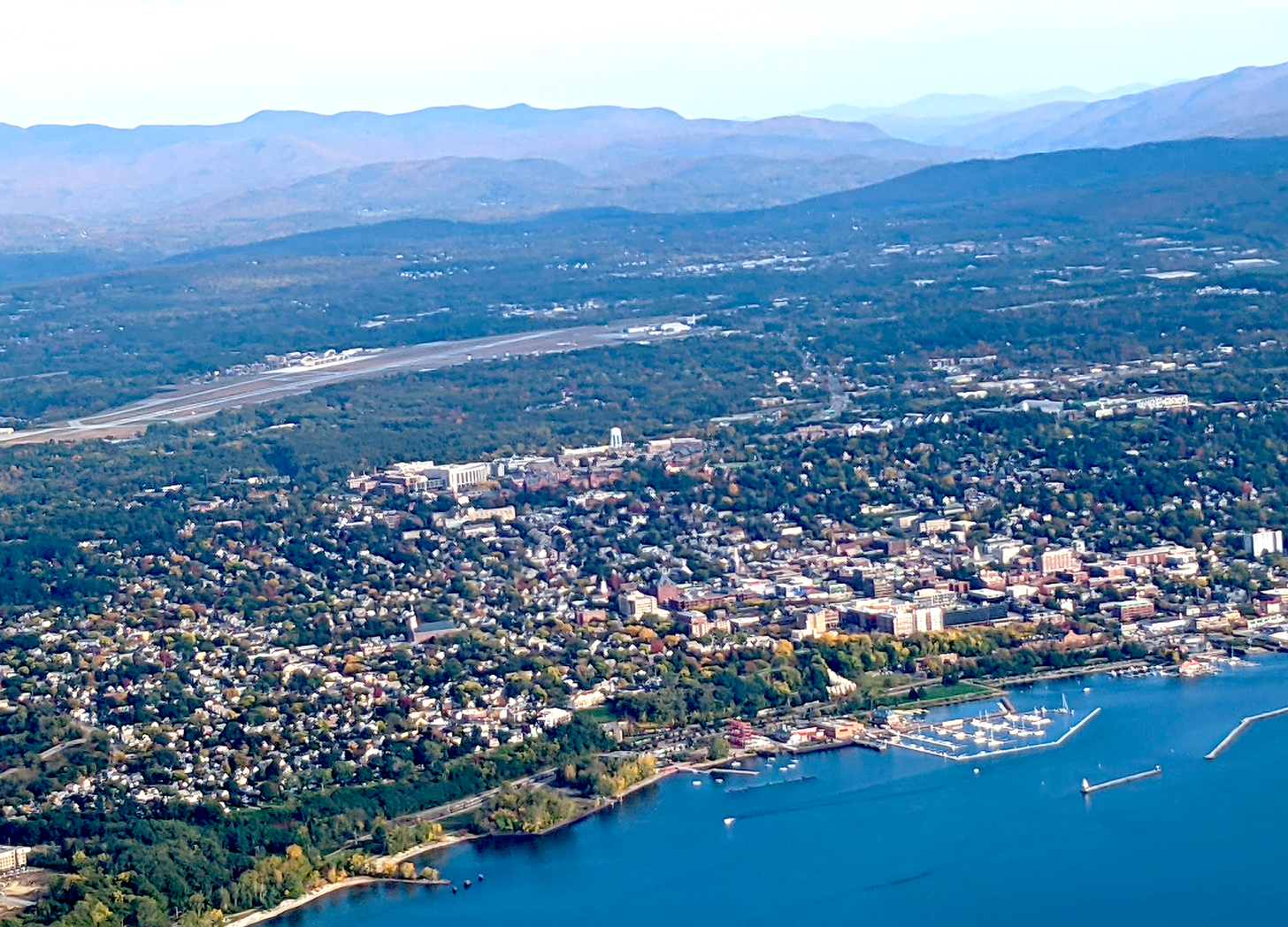
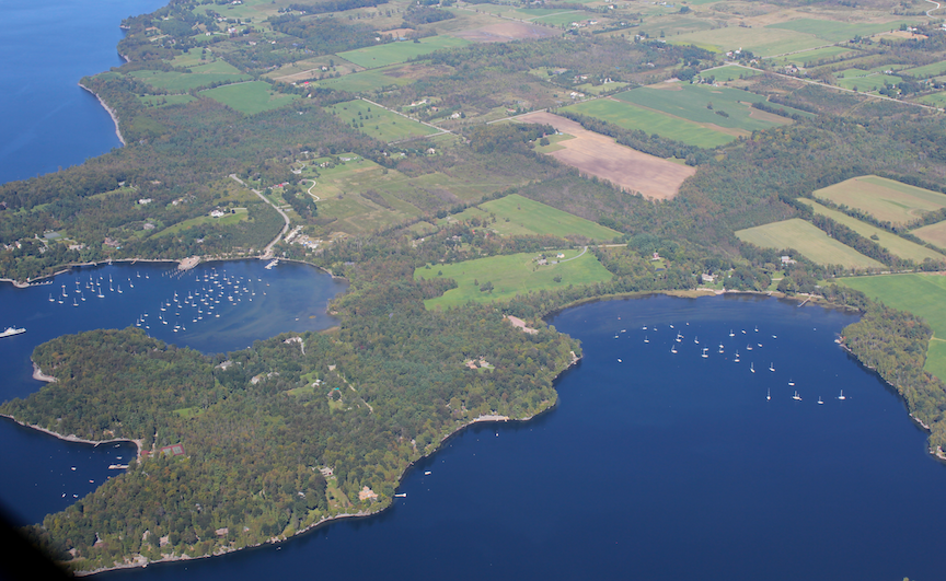
American splendor: east shore of Lake Champlain south of Burlington.

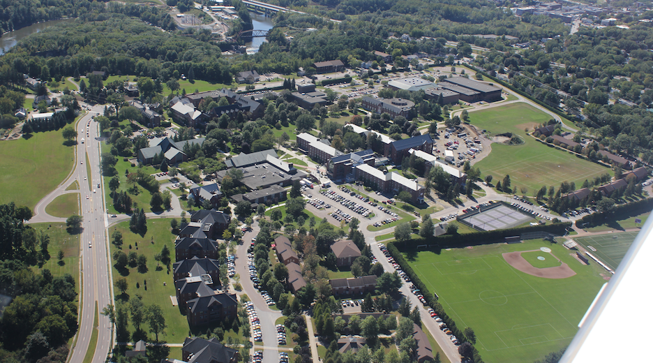
American higher ed: a view toward St. Michael’s College, in Burlington. You see part of the leading edge of the plane’s right wing. My wife was taking pictures from her side of the plane, while I was lining up to land.

No larger moral, except to give a small sample of how different even such familiar territory as the Northeastern-corridor states can look from a few thousand feet up.

Tweet
Share
Share
Share

Newsletter

For more from Our Towns, please sign up for our newsletter here.


Latest

  • Image of children playing around a water tower, with bright paintings on it and the message "You Have Found Lost Hills" 1
    Finding the City of Lost Hills
    • June 4, 2025
  • Library building on a sunny day in San Diego. 2
    How Libraries Are Becoming ‘Sustainable’
    • August 6, 2024
  • Children doing nature drawings, in antique photo. 3
    Sustainability: Suddenly the action is local.
    • May 9, 2024

Related Articles

The path a regional jet took this past Thursday, after taking off from Dulles airport outside Washington and then quickly returning, following a clockwise route. The plane is ID’d on this map as Delta 3857, and its passengers had Delta tickets. On air-traffic frequencies it is called “SkyWest 3857,” the name of the Delta feeder airline. (This image is a screenshot from the AirNav RadarBox site.)
View Post
  • Aviation

Cooperation, Calm, and Competence: This Is How It Sounds

  • James Fallows
  • February 1, 2022
View Post
  • Aviation

The Quiet Competence That Makes the Country Run

  • James Fallows
  • October 20, 2021
Banking to the right, looking through the clouds toward the water and the ground. (Deborah Fallows)
View Post
  • Aviation

In Flight

  • Deborah Fallows
  • January 17, 2017

STAY CONNECTED

Receive the latest news and updates

SUBSCRIBE

© 2025 Our Towns Civic Foundation. All Rights Reserved.

  • Contact
  • Privacy Policy
  • Republishing Policy

Input your search keywords and press Enter.