• Recent
  • Towns
  • Topics
    • Arts
      • Language
      • Museums & Galleries
      • Public Art
    • Civic Life
      • Citizen Engagement
      • Governance
      • Health & Well-Being
      • Refugees
    • Community Heart & Soul
    • Economic Development
      • Breweries & Distilleries
      • Entrepreneurs
      • Transportation
    • Education
      • K-12
      • Community Colleges & Technical Training
      • Colleges & Universities
    • Environment & Sustainability
      • Parks & Recreation
      • Trees
    • Local Institutions
      • Libraries
    • Local Journalism
    • Travel
      • Aviation
  • Homepage
  • About
  • Donate
  • Newsletter
  • Recent
  • Towns
  • Topics
    • Arts
      • Language
      • Museums & Galleries
      • Public Art
    • Civic Life
      • Citizen Engagement
      • Governance
      • Health & Well-Being
      • Refugees
    • Community Heart & Soul
    • Economic Development
      • Breweries & Distilleries
      • Entrepreneurs
      • Transportation
    • Education
      • K-12
      • Community Colleges & Technical Training
      • Colleges & Universities
    • Environment & Sustainability
      • Parks & Recreation
      • Trees
    • Local Institutions
      • Libraries
    • Local Journalism
    • Travel
      • Aviation
  • Homepage
  • About
  • Donate
  • Newsletter
  • Aviation

A Theory of Mountain Flying

The safety virtues of multi-modal transportation.

  • James Fallows
  • August 22, 2013

Share

Here is my theory of mountain flying: I don’t like it.

This incredible video, from Peru, will give you an idea of the kind of thing I have nightmares about. For me, the most “have to look away” moments are the ten seconds starting around time 1:30, although 0:30 and 0:45 are pretty frightening too.

I don’t like mountain flying because it’s objectively dangerous and it’s subjectively frightening. The winds are often turbulent, so you’re bouncing around with all that granite nearby. In the summer you often have thunderstorms, and in the winter you often have ice or snow. You worry about the narrowing gap between how high you have to go to clear the terrain, and how low you have to stay to avoid the clouds. I have taken mountain-flight training, and I’ve flown across the Rockies several times, in summer and winter, and the Sierra a few times. But … why?

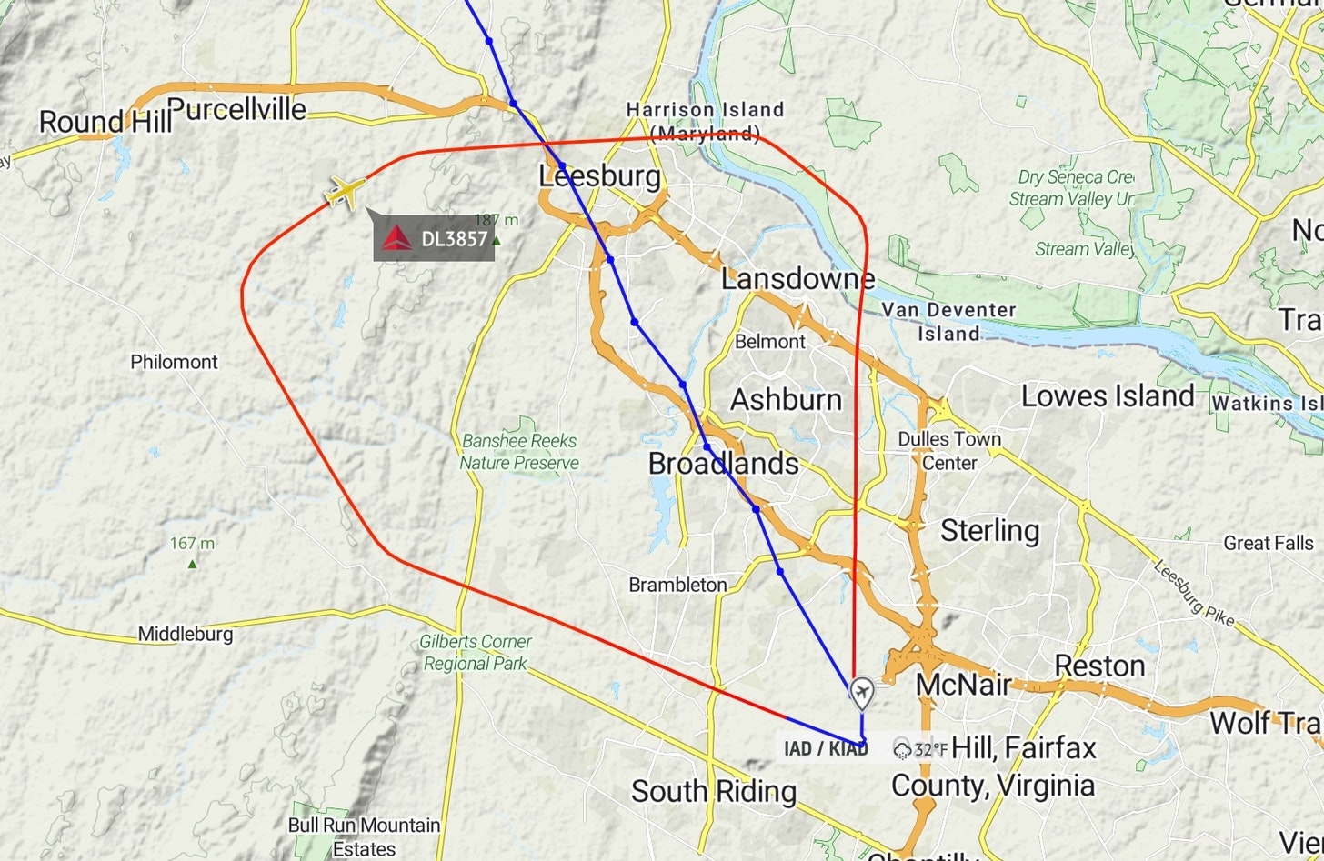
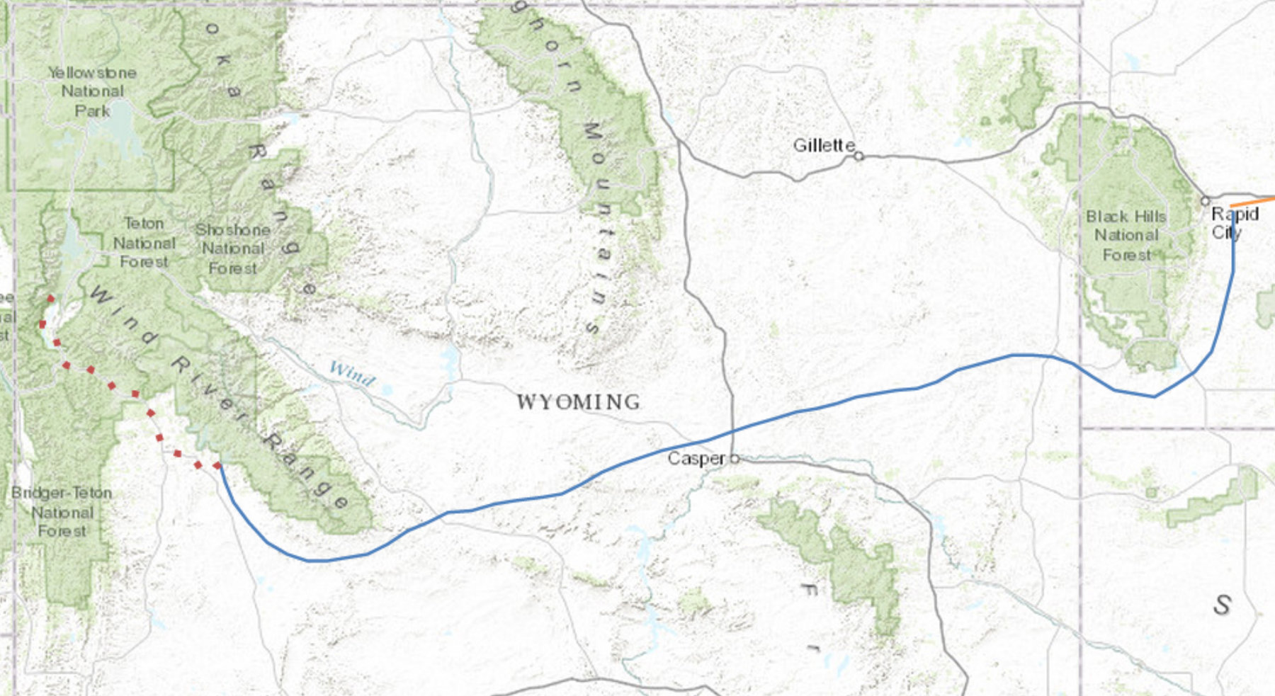
Thus, as a guide for our current journey, we’re using multi-modal travel: fly, then drive. If we have to get to Sun Valley, Idaho? Instead fly to Twin Falls, Idaho — a great big runway in a big, flat valley — and drive from there. Atlantic events in Aspen? Fly to Boulder and drive. Right now we are at a meeting in Jackson, Wyoming. There is an airport here, but it involves mountains, and while they’re not that ominous the weather is not so great. I’d spend all night worrying before the flight in and the flight out. Instead, fly to Pinedale — a great big runway in a big, flat (although high, 7000-ft) valley — and drive from there, as we have done. Hence our route from Rapid City, SD to Pinedale, WY strategically avoiding the high ground of the Black Hills and the Wind River range along the way. The blue is the flying part, the dotted-red is the rental-car driving.

No larger point, except (a) to give a link to the amazing video above and (b) as ongoing real-time chronicle of Aeronautical Decision Making.

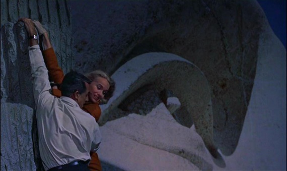
Also: Yesterday, when leaving Rapid City, we had a chance to fly by Mount Rushmore and do a North by Northwest reprise.  Instead I veered off when we were about 10 miles away, too far for any interesting pictures. Rain was building in the area, and the winds were gusty, and several tourist helicopters were reporting turbulence, and I thought, another time. So we will not have our update to the scene below:

Tweet
Share
Share
Share

Newsletter

For more from Our Towns, please sign up for our newsletter here.


Latest

  • Image of children playing around a water tower, with bright paintings on it and the message "You Have Found Lost Hills" 1
    Finding the City of Lost Hills
    • June 4, 2025
  • Library building on a sunny day in San Diego. 2
    How Libraries Are Becoming ‘Sustainable’
    • August 6, 2024
  • Children doing nature drawings, in antique photo. 3
    Sustainability: Suddenly the action is local.
    • May 9, 2024

Related Articles

The path a regional jet took this past Thursday, after taking off from Dulles airport outside Washington and then quickly returning, following a clockwise route. The plane is ID’d on this map as Delta 3857, and its passengers had Delta tickets. On air-traffic frequencies it is called “SkyWest 3857,” the name of the Delta feeder airline. (This image is a screenshot from the AirNav RadarBox site.)
View Post
  • Aviation

Cooperation, Calm, and Competence: This Is How It Sounds

  • James Fallows
  • February 1, 2022
View Post
  • Aviation

The Quiet Competence That Makes the Country Run

  • James Fallows
  • October 20, 2021
Banking to the right, looking through the clouds toward the water and the ground. (Deborah Fallows)
View Post
  • Aviation

In Flight

  • Deborah Fallows
  • January 17, 2017

STAY CONNECTED

Receive the latest news and updates

SUBSCRIBE

© 2025 Our Towns Civic Foundation. All Rights Reserved.

  • Contact
  • Privacy Policy
  • Republishing Policy

Input your search keywords and press Enter.