• Recent
  • Towns
  • Topics
    • Arts
      • Language
      • Museums & Galleries
      • Public Art
    • Civic Life
      • Citizen Engagement
      • Governance
      • Health & Well-Being
      • Refugees
    • Community Heart & Soul
    • Economic Development
      • Breweries & Distilleries
      • Entrepreneurs
      • Transportation
    • Education
      • K-12
      • Community Colleges & Technical Training
      • Colleges & Universities
    • Environment & Sustainability
      • Parks & Recreation
      • Trees
    • Local Institutions
      • Libraries
    • Local Journalism
    • Travel
      • Aviation
  • Homepage
  • About
  • Donate
  • Newsletter
  • Recent
  • Towns
  • Topics
    • Arts
      • Language
      • Museums & Galleries
      • Public Art
    • Civic Life
      • Citizen Engagement
      • Governance
      • Health & Well-Being
      • Refugees
    • Community Heart & Soul
    • Economic Development
      • Breweries & Distilleries
      • Entrepreneurs
      • Transportation
    • Education
      • K-12
      • Community Colleges & Technical Training
      • Colleges & Universities
    • Environment & Sustainability
      • Parks & Recreation
      • Trees
    • Local Institutions
      • Libraries
    • Local Journalism
    • Travel
      • Aviation
  • Homepage
  • About
  • Donate
  • Newsletter
  • Aviation

The Long Stretch Home

The fourth day of a cross-country flight

  • Deborah Fallows
  • December 16, 2014
A Christmas-y color scheme for Thanksgiving week travels: starting and ending points with red pins, overnights with green pins, fuel stops with red flags, and highlights for the Oklahoma farmstead and Meteor Crater. (Map with Esri software, by John Tierney)

Share

Finally it is time for a report on Day 4 of our cross-country trip for our American Futures project. Days 1, 2, and 3 are here, here, and here.

The remnants of Caroline Henderson’s farm, as we flew out of Guymon, Oklahoma (Photos: Deborah Fallows)

We departed Guymon, Oklahoma, bound for our destination of Redlands, California, about 1,000 miles away. We were in that tiny slice of the Oklahoma panhandle, almost touching Kansas, Colorado, New Mexico, and Texas. Headwinds had been strong the entire way across the country, and we expected this to be no different. But we were also expecting the most spectacular scenery of the trip, through the width of New Mexico and Arizona and on into California.

We juggled our fuels stops as we went, always looking for cheap gas, big runways, and favorable wind conditions. Jim’s pilot software can tell us all those things in real time, which seems miraculous to me. We can also listen to Sirius XM radio, which brings us out of the quiet skies when we so choose to headline news, or rock or classical music, or Rural Radio, which is one of my favorites. [Jim asks me to note that any transmission with Air Traffic Control automatically blanks out the Sirius transmission. We turn it off when we’re near busy air space, where the ATC talk is nonstop, and mainly listen on long cross-country hauls like this.] On that day, we were listening to play-by-plays of a bull-riding rodeo competition.

The weather was perfect. The landscape changed from this:

Departing from the farm lands

To this:

Entering the desert scrub lands

To this:

Giving way to mesas of New Mexico

We decided to stop in Santa Fe. It hurts to land in beautiful places when you know all you have time for is refueling. This was such a place, although the FBO (“fixed base operator,” where there is gas and sometimes a lounge or restaurant) offered a little bit of Santa Fe, with a western adobe architecture and shelves of local products in the lounge. It was one of those FBOs that caters to more high end private planes than ours, the Citations, Gulfstreams, and for-charter NetJets and Executive Jets. The waiting area of the FBO was filled with women sporting leather boots, pressed jeans, crisp white shirts, and perfect hair. That is a far cry from FBOs in Oklahoma like Okmulgee or Guymon, where I fit right in with sneakers, rumpled jeans, and headset-hair, which screams “single-engine, 4-seater.” Not that I don’t love our plane. And none of those jets has a parachute for the entire plane.

More desert vistas

In a charming moment, the FBO desk attendant saw me blanch when the fuel price shown at the desk was more than a dollar more per gallon than that advertised on the software. She quietly and generously whispered that the less expensive self-serve AvGas (aviation gas) was down at the end of the field, if we’d like to pump it ourselves. I could tell I wasn’t the first with that reaction.

Then off we flew to look for the piece de resistance of our journey. I had seen Arizona’s meteor crater from 35,000 feet in a commercial airliner before and was really excited about seeing it from about 1,500 feet.

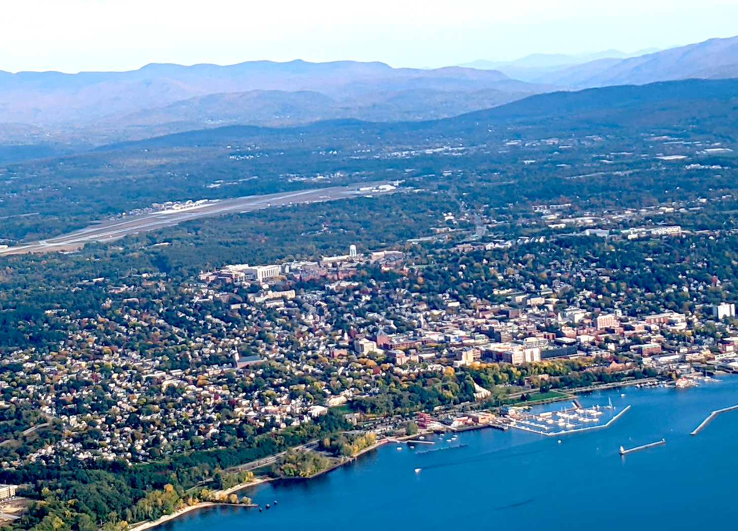
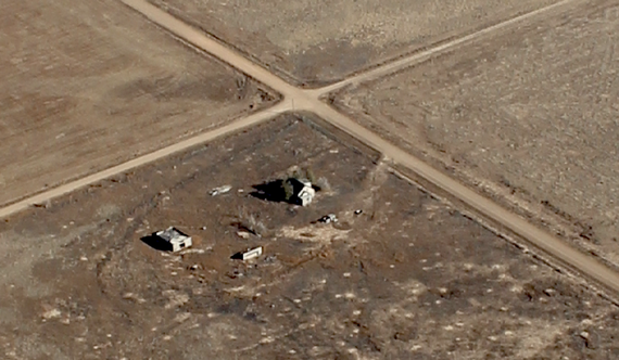
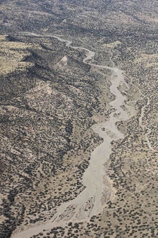
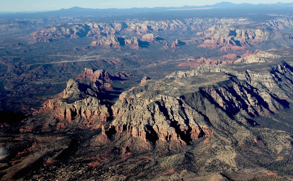
We flew over views like this:
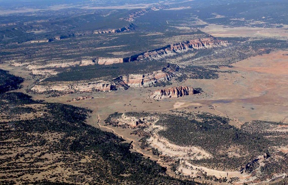
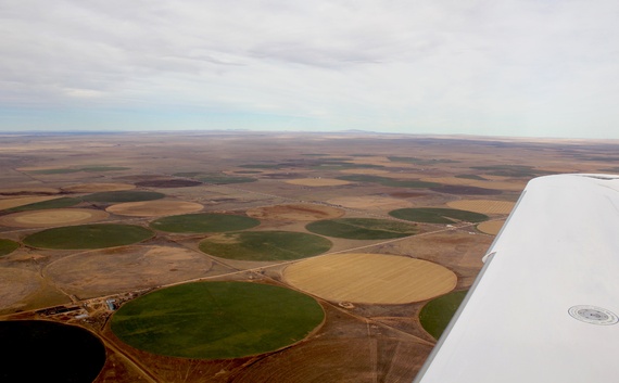
New Mexico’s scenery

And this:

Loving this

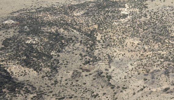
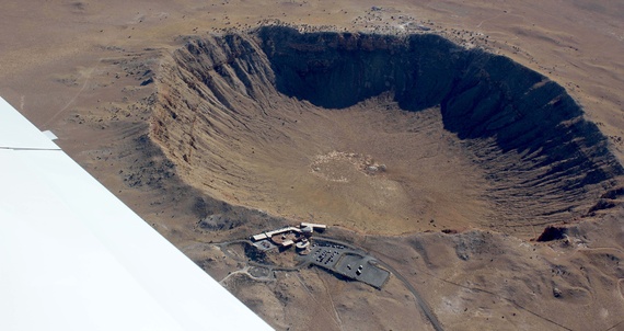
And then spotted the crater:

Meteor crater near Winslow, Arizona

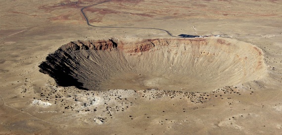
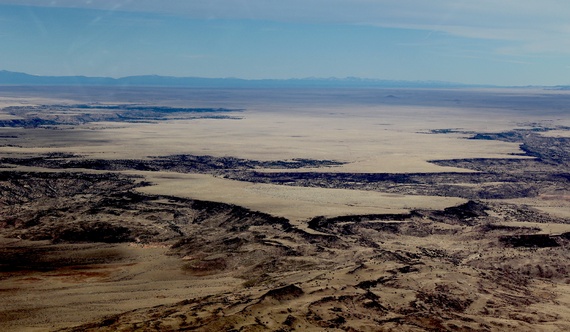
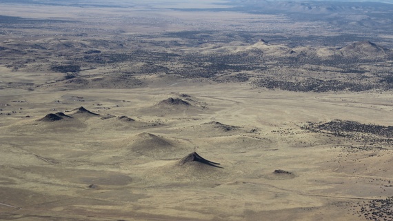
And this, from another angle:

You can see the tourist headquarters

We veered away, toward another refueling stop in Prescott, Arizona:
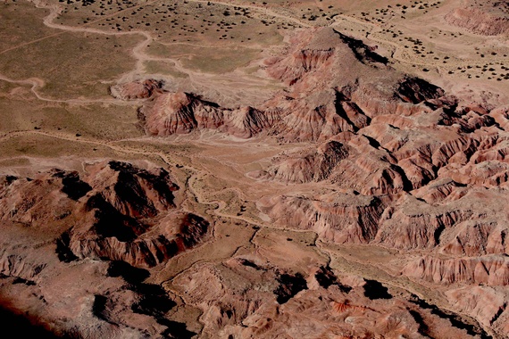
Never get tired of looking out the window of the Cirrus

And more:

Funny little desert bumps near Prescott, Arizona

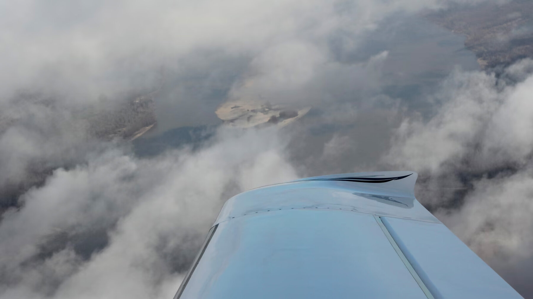
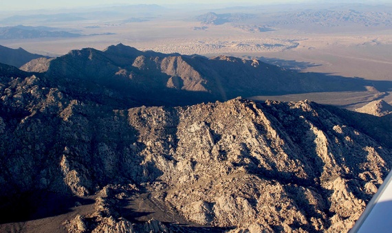
And finally, heading over the mountains in southern California:

Heading over the mountains in SoCal toward the Cajon Pass

We landed in California just about twilight. Over four days, we stayed overnight in three places: Huntington, West Virginia; Little Rock, Arkansas; and Guymon, Oklahoma. We stopped for fuel four additional times. We covered about 2,600 miles, in nearly 16 hours of flying, with headwinds ranging from 10 knots to 40 knots. Our flying speed over ground was from about 135 knots to about 165. (In low-wind conditions, we cruise at about 170 knots, and have gone as fast as 217 knots with a strong tailwinds in excess of 40 knots.) We flew at altitudes from about 1,500 feet over the desert to (briefly) 12,000 feet over the mountains. When we landed, Jim and I agreed that we had really been somewhere and seen something of this vast country. And we would do it again.

Tweet
Share
Share
Share

Newsletter

For more from Our Towns, please sign up for our newsletter here.


Latest

  • Image of children playing around a water tower, with bright paintings on it and the message "You Have Found Lost Hills" 1
    Finding the City of Lost Hills
    • June 4, 2025
  • Library building on a sunny day in San Diego. 2
    How Libraries Are Becoming ‘Sustainable’
    • August 6, 2024
  • Children doing nature drawings, in antique photo. 3
    Sustainability: Suddenly the action is local.
    • May 9, 2024

Related Articles

The path a regional jet took this past Thursday, after taking off from Dulles airport outside Washington and then quickly returning, following a clockwise route. The plane is ID’d on this map as Delta 3857, and its passengers had Delta tickets. On air-traffic frequencies it is called “SkyWest 3857,” the name of the Delta feeder airline. (This image is a screenshot from the AirNav RadarBox site.)
View Post
  • Aviation

Cooperation, Calm, and Competence: This Is How It Sounds

  • James Fallows
  • February 1, 2022
View Post
  • Aviation

The Quiet Competence That Makes the Country Run

  • James Fallows
  • October 20, 2021
Banking to the right, looking through the clouds toward the water and the ground. (Deborah Fallows)
View Post
  • Aviation

In Flight

  • Deborah Fallows
  • January 17, 2017

STAY CONNECTED

Receive the latest news and updates

SUBSCRIBE

© 2025 Our Towns Civic Foundation. All Rights Reserved.

  • Contact
  • Privacy Policy
  • Republishing Policy

Input your search keywords and press Enter.