Economic & Business Development

WHAT RURAL ECONOMIES LOOK LIKE FROM ABOVE


Author's Image
Posted on

Feedlot enclosures on the east side of Dodge City, Kansas (Deborah Fallows)

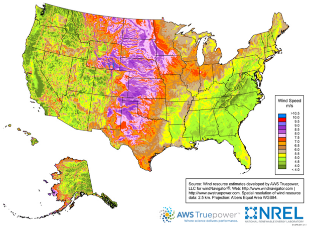
I’ve spent the past week in western Kansas. Yesterday I mentioned the vast arrays of wind turbines that my wife Deb and I saw in Spearville, just east of Dodge City. They can be a significant part of the region’s economic future, given the natural advantage of the plains states in wind-generation potential—as shown on the map below. The biggest-picture policy questions about wind energy are not my topic at the moment. They’re for another time. I’m just setting up some photos I’d like to show.

Average wind speeds across the United States, via the Department of Energy’s National Renewable Energy Lab. The turbines outside Dodge City, Kansas, are in one of the windiest, purple-marked areas in southwestern Kansas. (U.S. Energy Information Administration.)

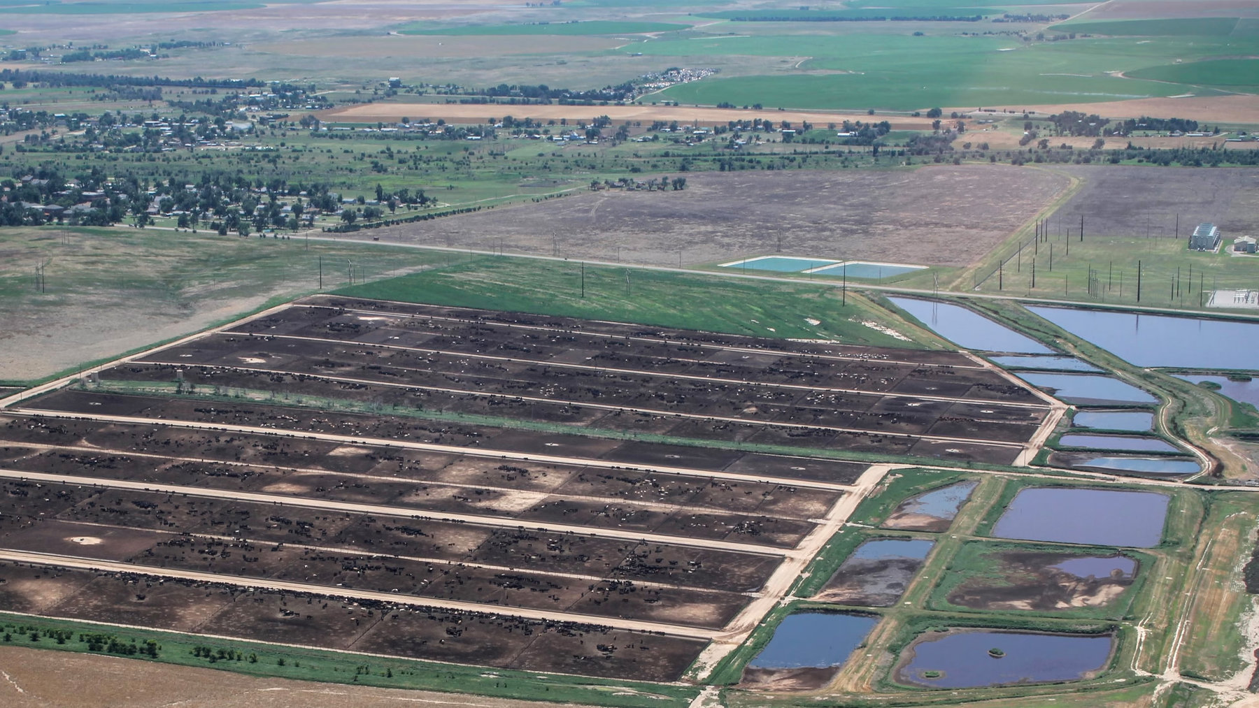
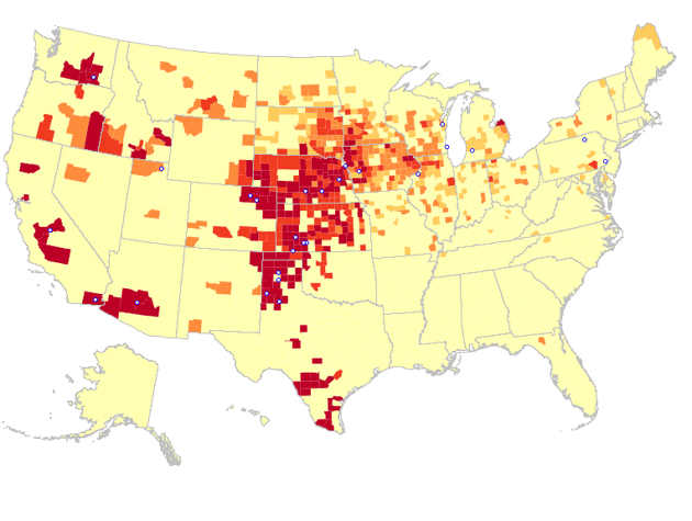
I also mentioned yesterday the role of beef packing houses as the dominant employers in the Kansas towns of Dodge City, Garden City, and Liberal. This map, showing cattle concentrations across the country, interestingly parallels the wind map. And in this one too, the southwestern corner of Kansas is a center of activity.

Concentrations of cattle in the United States, via Food & Water Watch. The same southwestern corner of Kansas that has a lot of wind also has a lot of cows in feedlots, for the concentration of packing houses there.
* * *
So what might this activity look like from above? Here’s what. The first photo shows a small part of one of the several large feedlots in the Dodge City area—this one is just east of town. We saw it almost immediately after taking off.

A feedlot just east of Dodge City, Kansas (Deborah Fallows)

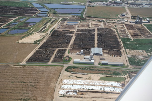
The black dots you see within each feedlot enclosure are of course the cattle.

Less than a minute later, we had turned northward. The stretch of Highways 50 leading east from Dodge City toward Spearville came into view. Past the grain elevators that dominate the tiny town of Wright in the foreground of the photo below, we could see the just beginning of the large Spearville area wind turbine fields.

The little town of Wright, Kansas, on the right side of the highway, in the foreground. The wind turbines of the Spearville area are the white structures in the distance. (Deborah Fallows)

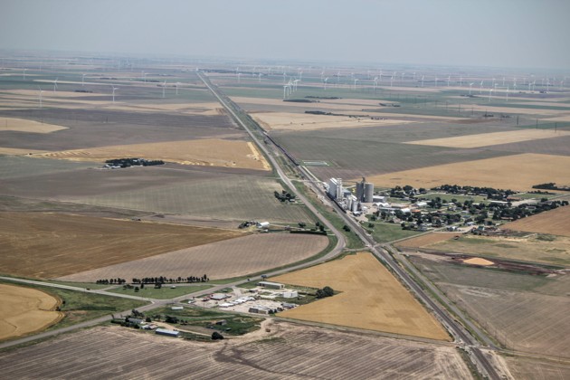
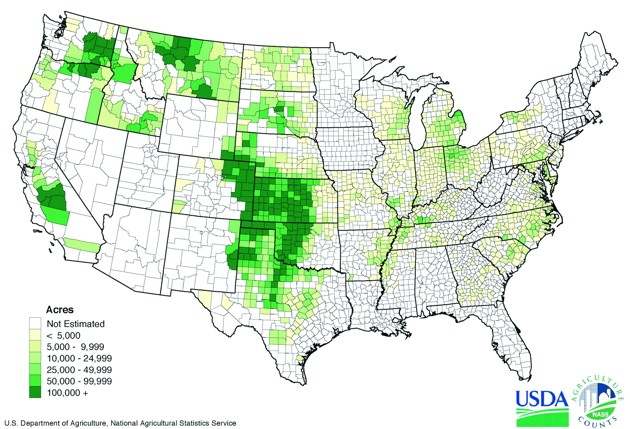
Of course the original and ongoing foundation of the area’s economy is farming, especially wheat. Why not one more map? Here is wheat production, again with a focus on Kansas:

Winter wheat acreage, via U.S. Department of Agriculture.

Here is how that part of the region’s economy looked this afternoon. This shot was taken just a few minutes after the ones above. It shows the stunning beauty and precision of the harvest.

Wheat harvest, June 24, 2016, western Kansas. Note the combines working their way around the edge. (Deborah Fallows)

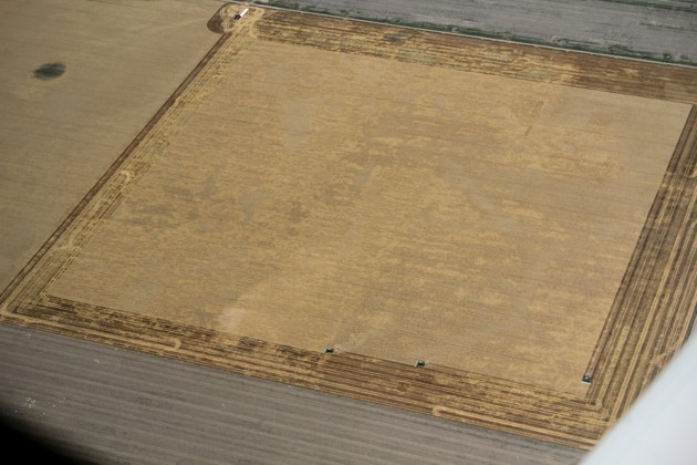
Sometimes the aerial view is unrevealing about activities at ground level. Software companies, for example, usually look like warehouses from above. Other times, it has a storybook quality, of illustrating the way that natural features and human efforts intertwine. Today’s view had that quality.

RELATED ARTICLES